

Kumano Kodo Nakahechi Route: My Day-by-Day Guide

Preface: I hiked the Nakahetchi route in July of 2023. I chose to do it in 4 days / 5 nights, starting in Kii Tanabe and ending in Kii Katsura. We took a local bus to the start of the trail and from the end to Kii Katsuura, but walked the ~70km in between. This guide will be based on my experience, plus what I’ve learned researching and talking to people along the way.
Winding through the Kii Peninsula, the Nakahechi Route connects Kii-Tanabe, on the western coast, to the Kumano grand shrines at Hongu and Nachisan, and finishes a Nachi Falls (a wonder in itself). With a history dating back over a thousand years, this trail was traversed by Japan’s imperial family, and today it welcomes travelers from around the world seeking a unique and inspiring adventure.
The hike itself takes you through cypress and cedar forests, across 3 main mountain ranges, and along crystal-clear rivers and swimming holes.
My favorite part of the Nakahechi Route is the immersion into rural Japan. Small, isolated villages offer warmth and hospitality, inviting visitors to fully experience the region’s rich culture.
In this blog post, I’ll share everything you need to know before embarking on the Nakahechi Route of the Kumano Kodo.
Table of Contents
Key Takeaways
The Nakahechi Route is the classic first Kumano Kodo hike. It is roughly 70 km depending on exactly where you start and finish, and most people walk it over 4 or 5 days.
Most walkers go west to east: Kii-Tanabe, bus to Takijiri-oji, then on foot toward Hongu, Koguchi, Nachi Falls and Kii-Katsuura.
Read More: You can read my complete guide to the Kumano Kodo here or my tips on booking accomodation here
History and Significance

The Nakahechi path, often referred to as the “Imperial Route,” was frequented by emperors and nobles from the 10th century onwards2. This famous route takes pilgrims through breathtaking mountain landscapes and sacred sites that are integral to Japan’s spiritual heritage.
Two of the major religions in Japan, Shinto and Buddhism, had a significant influence on the development and reverence of the Kumano Kodo, including the Nakahechi route3. Spiritual seekers would embark on this pilgrimage in search of purification, seeking to encounter the “Three Grand Shrines of Kumano”.
Today, this mountainous pilgrimage is still popular among both locals and foreign visitors, and I can clearly see why. The Nakahechi route not only introduces you to Japan’s rich religious history and stunning natural beauty but also offers a unique sense of connection with those ancient pilgrims that walked the trails centuries ago4. Walking the Kumano Kodo, even for just a few days, was a truly unforgettable experience of history, nature, and spirituality.

Kumano Kodo’s Connection to Camino de Santiago
Interestingly, the Kumano Kodo shares a unique connection with another famous pilgrimage route, the Camino de Santiago in Spain. In 1998, they became sister trails, recognizing their shared cultural and spiritual significance. Both routes have attracted pilgrims for over a thousand years, making them historical treasures.
Tip: By completing the kumano kodo and at least 100km of Camino de Santiago you can get stamped a ‘dual pilgrim’. Look out for the stamp book at the Kumano Kodo visitator centres and make sure to get the Kumano stamp in the Hongu Taisha shrine to be elegable for your dual pilgrim certificate.
Getting The Dual Pilgrim Certificate
For those who complete both the Kumano Kodo and the Camino de Santiago pilgrimage routes, there’s a special reward: the Dual Pilgrim Certificate. You’ll need to get the stamp at hongu taisha to be able to get your Dual Prilgrim certificate.
(More on the Dual Pilgrim certificate in the article here)
Getting To The Nakahechi Trail.
The Nakahechi route begins at Takajiri Oji, where the Kumano Kodo visitor center is also located (across the road)
But your adventure actually starts much earlier, getting from central Japan down to Wakayama and eventually the start of the trail.
It’s a bit of a mission – so factor this into your planning
Kii-Tanabe, located on the western coast of Wakayama Prefecture, is accessible by express trains from Kyoto and Osaka 1. The ride takes 1.5 – 3.5 hrs depending on where you leave from and what train service you chose
| Starting Point | Destination | Approximate Time |
|---|---|---|
| Kansai Airport Osaka | Kii Tanabe | ~2hrs |
| Osaka Central | Kii Tanabe | ~2hr 20min |
| Kyoto Central | Kii Tanabe | ~3hrs |
What I Did: We flew into Kansai Airport and wanted to go straight to Tanabe (and we’re glad we did. Tanabe was a cute beach town, which was really charming). We took the Airport train from Kansai station to Hineno (2 stops). Then we got off and purchased a limited express ticket on the Wakayama line to Kii Tanabe Station.
Note: These are actually 2 tickets. You need to buy the base ticket, and then also reserve a seat.
Tip: You definitely want the limited express train. There’s also the option of taking local trains but these go much slower and stop at every station along the way (and there’s a lot!). Pay a little extra and you’ll have at least 90 minutes off your journey.


Nakahechi Route Overview
The Kumano winds through the beautiful landscapes, connecting the three grand shrines of Kumano: Kumano Hongu Taisha, Kumano Hayatama Taisha, and Kumano Nachi Taisha. These shrines, collectively known as the Kumano Sanzan, are the focal points of the pilgrimage.
As I set off from Kii-Tanabe, my first encounter on the Nakahechi route was Takijiri-Oji, a trailhead approximately 15km west of Tanabe. This is where most pilgrims begin their journe and is where the Kumano Kodo visitor centre is located.
Walking along the trail, I came across several small, isolated villages that offer traditional lodgings for (which you can book here) These are called ryokans or japanses inns. They have an old world charm about them, which is helped by the etiquete required when you’re staying at one.
This was my favourite part of the whole experience!

- Day 1: Take a local bus from Kii Tanabe to the trailhead in Takijiri Oji. Sign in to the visitor centre and hike approximately 13km / 5hrs to Chikatsuyu
- Day 2: Hike aproximatly 25km or 8-9hrs from Chikatsuyu to Hongu Taisha or Yunomine Onsen
- Day 3: Continue 13.5km / 4.5 hrs to Koguchi
- Day 4: From K walk 14.5km to Nachi Falls, then take another local bus from the trail end down to kii katsura on the coast
| Day | Description | Distance To Walk | Time Taken | Notes |
|---|---|---|---|---|
| Day 0 | Travel Day | |||
| Day 1 | Hiking Day | 13km | 4.5 hrs | The warm-up |
| Day 2 | Hiking Day | 25km | 8-9hrs | Longest Day |
| Day 3 | Hiking Day | 13.5km | 3.5-4hrs | The ‘rest’ day |
| Day 4 | Hiking Day | 14.5km | 5-6hrs | Most challenging day |
| Day 5 | Travel Day |
One of my other favorite parts was reaching Hongu – the spiritual heart of the Kumano Kodo trail. Here, I visited Kumano Hongu Taisha, one of the grand shrines, nestled in lush green surroundings.
From Hongu, the Nakahechi route continues eastward through the mountains, eventually leading to the other grand shrines: Kumano Hayatama Taisha in Shingu and Kumano Nachi Taisha near the coast.
Overall, I highly recommend this adventure for those looking to connect with Japan’s spiritual and cultural past on a deeper level. The hike is not too challenging – but there is a lot of hill climbing with around ~800m of elevation gain each day. The rivers are gorgeous, the food is incredible, and the accommodation is very very cute.
Read more: for a full write up of the route and what to expect on the hike, check out this article
Getting Back Again
Once finished the route, you’ll end up at one of two trailheads. The Nachi Falls end (most common) or the Kumano Hayatama Taisha.
(we picked the route to Nachi Falls / Nachi Taisha as it’s the most poulatar, and the grand shrine looked stunning!)
From there you’ll take a bus into the nearest main town which is Kii Katsuura – a small fishing village, but also home to the 2nd largest tuna port in Japan outside of Tokyo (well worth a visit).
The bus from Nachi Falls to Kii Katsuura cost 630 Yen and took about 45 minutes.

We stayed the night here (I would recommend you do the same or even stay two nights!) it’s a cute town and one of the highlights of my trip. You can visit the tuna market and enjoy the nearby onsens.
Next, you’ll probably want to make your way back to Osaka, Kyoto or Kansai Osaka Airport. The most common route is back along the coastal route, and you’ll pass Tanabe on your way.
Add an extra 90minutes to the time it took to get you to Tanabe at the start of your hike

Key Locations along the Nakahechi Trail
The old way of explaining this route is to list the villages one by one: Takijiri-oji, Takahara, Chikatsuyu, Hongu, Koguchi, Nachi. Useful, but only halfway there.

The Kumano Travel booking walkthrough, a printable packing checklist and budget planner, the trail map and the full Google Maps pin set — one instant download.
Get the Planning Kit — $27What you actually need is the sequence: how far you walk each day, where the climbs are, where you can buy food, where you sleep, and where it makes sense to slow down.
So here is the route as I would plan it: four walking days, with a night in Kii-Tanabe before you start and Kii-Katsuura after you finish. If you can spare the time, I would stretch it to five walking days by stopping in Takahara or Nonaka, or by giving Hongu/Yunomine a slower night.
My 4-Day Nakahechi Itinerary
Those numbers are the official Tanabe route data, and they are worth taking seriously. The Nakahechi is well marked and friendly to independent walkers, but it is still a mountain route with big climbing days. In July, with humidity doing its worst work, those numbers felt very real.
Also: book accommodation first. Then fit the walking around the rooms you can actually get. This is not the sort of trail where you casually roll into a tiny village at 5pm and browse ten guesthouses like you are in Chiang Mai.
Day 0: Arrive in Kii-Tanabe
I would treat Kii-Tanabe as part of the hike, not just a transport chore. Arrive the day before, collect maps if you need them, get cash, buy snacks, sort your luggage transfer, and make sure you know which bus you are taking to Takijiri-oji in the morning.
The original logistics section above covers how we got there from Kansai Airport. Short version: do not land in Japan, charge down to Tanabe, and try to start walking the same day unless you enjoy making holidays unnecessarily stupid.
Day 1: Takijiri-oji to Chikatsuyu

Officially, Takijiri-oji to Chikatsuyu is about 13.3 km, 6-8 hours, with roughly 1,010 m of climbing and 840 m of descent. That is from the official Takijiri to Chikatsuyu route notes, and yes, the climb starts quickly.
You start at the Kumano Kodo Kan Pilgrimage Center near Takijiri-oji. Use the toilet, stamp your book if you are doing the pilgrim thing, fill water, then cross the road and start climbing. It is a proper little wake-up call. The route lifts you out of the valley and into the forest almost immediately.
Takahara is the obvious first milestone. It is only about 3.7 km from Takijiri, but the climb makes it feel like you have properly started. Some people stay here to make the first day short and scenic. If you can get a room, fair enough. Waking up already in the mountains would be pretty nice.
From Takahara, the day settles into a more classic Nakahechi rhythm: forest, old oji sites, bits of road, more forest, then small villages where life is quietly happening around the trail. You pass Gyuba-doji-guchi before dropping toward Chikatsuyu, which sits in a river basin and feels like the first proper village stop.
Chikatsuyu has a small shop, some accommodation, the river, and enough signs of civilisation to feel very welcome after the first day. I swam under the bridge here and it was completely fine. Actually, in July, it was more than fine. It was medically necessary. I have a separate note on this in my Kumano Kodo swimming spots.
Tip: Food note: do not assume every cafe or shop will be open exactly when your sweaty self wants it. Carry lunch or snacks from Tanabe unless your accommodation has packed lunch sorted.
Day 2: Chikatsuyu to Hongu, Yunomine or Kawayu
This is the big mileage day. Chikatsuyu to Kumano Hongu Taisha is about 24.5 km, 9-12 hours, with roughly 1,100 m of climbing and 1,380 m of descent, according to the official Chikatsuyu to Hongu route notes.
It starts less romantically than you might imagine: a decent amount of road and village walking through Chikatsuyu, Nonaka and toward Kobiro-toge. But this is part of what I liked about the Kumano Kodo. It is not pretending to be wilderness. You are moving through rural Japan, past houses, fields, shrines, vending machines, closed-looking buildings that may or may not be open, and then back into the mountains.
The main stops to know are Tsugizakura-oji, Toganoki-jaya teahouse, Kobiro-toge, Jagata Jizo, Mikoshi-toge and Hosshinmon-oji. Do not read that list and imagine constant services. Much of it is historical stops, toilets, rest shelters or places that make sense for lunch. Bring a bento.
The official advice is blunt: there are no restaurants along this section. If you want a shorter day, use the bus options between Chikatsuyu/Nonaka and Hongu. Tanabe has a useful breakdown of the official Chikatsuyu to Hongu walking options, including bus-shortened versions from Kobiro-toge, Doyukawa-bashi or Hosshinmon-oji.
I would only do the full walk if you are fit, started early, and have dinner time locked with your accommodation. If you are staying in Yunomine or Kawayu, remember that Hongu Taisha is not necessarily your bed. You may still need a bus, shuttle, or extra walk over Dainichi-goe.
This is also where the accommodation becomes the whole point. A family-run minshuku, a bath, dinner appearing after a long day, and the quiet realisation that you do not need to make any more decisions until morning. Bliss.
Day 3: Hongu Area to Koguchi via Kogumotori-goe

The Kogumotori-goe section from Ukegawa to Koguchi is about 13 km, 4.5-6 hours, with roughly 670 m of climbing and 690 m of descent. That is the official Kogumotori-goe route notes, but your real day depends on where you slept the night before.
If you stayed in Hongu, Kawayu or Yunomine, first get yourself to Ukegawa. From Hongu, it is roughly 3 km on foot or a short bus. From Kawayu, it is closer. From Yunomine, you either bus around or add the Dainichi-goe connection, which is beautiful in theory and an extra effort in practice.
Between Ukegawa and the trailhead, there is a small grocery shop often mentioned as the place to grab drinks and snacks before Kogumotori-goe. Check locally, because small-town opening hours are not a sacred contract. The safer move is still to organise lunch through your accommodation.
The walking itself is quieter than the first half of the route. You get forest, ridge walking, viewpoints, and that slightly pleasing feeling that the day is not trying to destroy you. After the long Chikatsuyu-to-Hongu day, I liked this section.
One of my favourite little moments came before Koguchi, eating a bento on a rock in the river near Kowaze. No grand drama. Just cold water, lunch, tired legs and the village close enough that the day felt basically done. Absolute heaven.
Koguchi itself is small and logistically important. It sets you up for the final big day over Ogumotori-goe. There are not endless backup options, so if Koguchi is full, your route probably needs to move around the room availability.
Tip: Swimming note: the swimming hole at Koguchi campground is excellent, and the river near the road bridge before town was one of my favourite lunch stops. Watch water levels, obviously.
Day 4: Koguchi to Nachi Falls
Koguchi to Nachi is the hardest walking day on the Nakahechi. The official Ogumotori-goe route notes puts it at about 14 km, 7-9 hours, with roughly 1,260 m of climbing and 930 m of descent. It earns its reputation.
The first section out of Koguchi is Dogiri-zaka, which gains about 800 m in the first 5 km. The translation is usually given as something like Body-breaking Slope, which is a fairly unsubtle bit of branding. Japan does not always do gentle marketing.
There are no restaurants on this section either, so pack lunch. Jizo-jaya, around 6.2 km in, is the obvious break point because it has toilets and covered seating. After that you keep moving through forest, passes, old teahouse remains and eventually toward Funami-toge, where you can start getting glimpses toward the coast.
The descent to Nachi is long enough to make your knees aware of their job description. But then the finish is ridiculous: Nachi Taisha, Seiganto-ji, the pagoda and Nachi Falls all stacked together at the end of the walk.
It is one of the better hike endings I have had. You come out of days of forest and village walking and suddenly there it is: shrine, waterfall, coast not far away, and shoes that smell like a formal apology.
From Nachi Falls, take the bus down to Kii-Katsuura. I had this at 630 yen and about 45 minutes in my notes, but check current timetables locally. Either way, the flow is simple: finish at Nachi, bus down, eat something, find hot water.
Should You Walk It in 4 Days or 5?
I walked the Nakahechi in 4 days / 5 nights, and I think that is a good fit if you are reasonably fit and comfortable with long walking days. But I would not pretend it is the most relaxed version.
If I had to choose again, I would still probably book the 4-day version, because I like a proper walking day. But if the accommodation worked better, I would happily slow it down. The Kumano Kodo is not improved by rushing past the best bits.
How Hard Is the Nakahechi Route?

The Nakahechi is not technical, but it is not flat. It is well marked, self-guided hiking is realistic, and you are rarely in true wilderness. But the elevation stacks up, especially if you walk the whole thing from Takijiri to Nachi.
Day 2 is the long-distance day. Day 4 is the big climbing day. Day 1 starts sharper than expected. Day 3 is the one that feels merciful, assuming you are starting from Ukegawa and not adding heroic extras from your onsen village.
I hiked in July and it was unbearably hot. I have never sweated so much in my life. Humid, 35-degree days make even climbing a flight of stairs feel personal, let alone a mountain range.
If you are fit and used to hiking, you can do it. If you are not, take 5 days, use the bus-shortening options where they make sense, and send your big bag ahead. There is no honour in carrying your jeans over a mountain pass.
Accommodation, Luggage and Packing

Accommodation was my favourite part of the whole experience. The family-run ryokan and minshuku made the route feel much more intimate than a normal hike. The food was amazing and the cultural experience felt more authentic than almost anything else I did in Japan.
For on-trail stays, use my Kumano Kodo accommodation guide. The short version is Kumano Travel first for the minshuku/ryokan nights, then Booking.com for Kii-Tanabe and Kii-Katsuura.
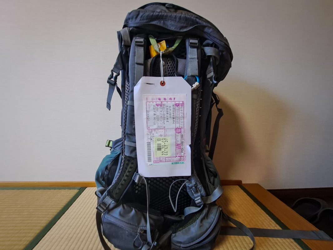
We also sent our ‘rest of Japan’ luggage from Tanabe to Kii-Katsuura and walked with lighter packs. In July heat, this was a very good idea. I explain the options properly in the luggage transfer guide.
Packing deserves its own post too, mostly because I packed a bunch of stuff I never needed and missed a few things I did. Full version here: Kumano Kodo packing list.
Kumano Kodo Trail Map

I also made a minimalist Nakahechi route map showing the main locations, start and end points, and trail stats. Not essential, obviously. But if you want something nicer than a screenshot to remember the walk by, this is where I would put it.
My Final Advice for the Nakahechi Route
If this is your first Kumano Kodo hike, I would still choose Nakahechi. It gives you the most complete version of the experience: shrines, forests, villages, rivers, onsen, family-run accommodation, a proper finish at Nachi and enough logistics to feel satisfying without becoming a full-time admin job.
Do not rush away from Kii-Katsuura either. Stay the night, eat tuna, find an onsen and let the trip land properly. My Kii-Katsuura guide has the full finish.
The Kumano Travel booking walkthrough, a printable packing checklist and budget planner, the trail map and the full Google Maps pin set — one instant download.
Get the Planning Kit — $27Kumano Kodo Travel Planning Cheatsheet
🚑 Should I buy travel insurance for Japan?
100% YES! — Japan has “free” healthcare but it’s only for citizens! Tourists need travel insurance in case anything happens on your visit. Also be aware many policies won’t cover hiking as it’s a high risk activity! (that’s right, check the t&c’s on your complimentary credit card insurance)
I highly recommend World Nomads as you can get specific add-ons for the crazy activities you’re doing – and starts at just $7 a day!
🏩 What’s the best way to book my Kumano Kodo accommodation?
Your only realy two options here are Kumano Travel and Booking.com. Its a complicated process so I wrote this guide here on the best kumano kodo accomodation options
If you don’t want to figure it all out (it’s meant to be a holiday after all) you can book a package tour. Here are my recommendations for both guided and self-guided.
💸How do you pay for things in Japan?
Japan may have flying robots.. but they also still use cash! So you’ll want to get some folding tender out from an ATM when you land. EFTPOS / Debit / Credit Card and Paywave (contactless payments) is common at bigger businesses but small bars, and street vendors want cash.
I personally use a Wise debit card for all my international money needs as they only convert the funds when you make payment, plus they offer a much better spread (margin on the true exchange rate) than the banks do. They work in all Japanese ATMs I tried.
→ Get the Wise card I use — set it up before you fly so it’s ready to tap the moment you land.
🚙 Do you need to rent a car in Japan?
I wouldn’t reccommend it — Transport in Japan is expensive whatever mode you chose, but fortunalty the publc transport system is out of this world in terms of both freqency and coverage. If you are heading to a lot of off the beaten track places, then you may want a rental. I use Discover Cars to find the cheapest rates on rentals cars and remember you can save money if you avoid picking up at the airport.
🚆 What about the JR Rail Pass?
We didn’t – but it depends on the length and itenirary of your trip. The JR Pass is expensive (and just went up in price again!) and if you’re walking the Kumano Kodo you wont need it for probably 6 days straight anyway.
Do the math, but in most cases buying the train fares you need, when you need it will work out more afforably overall – and give you more flexibility (as the JR Pass doesn’t cover all lines)
📲 How do I get internet/data/wifi in Japan and on the trail?
This one needs a whole nother article, but the short version is;
- local SIM cards are cheaper but generally require a fixed term contract (not practical for people visiting)
- Tourist ‘short stay’ SIMs are a bit more expensive but will give you plenty of data while your visiting and are best for solo travelllers.
- If you’re travelling as 2 or more people, renting a pocket WIFI unit from the airport is the most economical option – Works out cheaper than getting two tourists sims
- Use a travel eSIM like Airalo or Airalo. This works from the moment you land is is SOOOOO much easier than trying to pick a data pack in japanese. It also gives you connectivity across neighbouring asian countries if you buy a regional sim! TIP: Grab your Airalo eSIM before you fly and you’ll have data the moment you land, with no hunting for a SIM kiosk.
✈️ What’s the best site to buy flights to Japan?
For finding cheap flights, I recommend Skyscanner. Once you find the flight you’re looking for, I’d then suggest booking directly with the carrier (even if it costs a few $$ more than with one of the agreggators/agencies).
💧Can you drink the water on the Kumano Kodo?
Yes — Japan is very clean. In all townships you’ll pass through and stay along the Kumano Kodo the tap water is drinkable. If you want to drink water from the rivers and streams you generally can but should do so at your own risk. ALWAYS follow best practice and drink from fast flowing water as far up stream as possible. I drank the water and was fine.. but i’d generally recommend a Brita Water Bottle for rehydrating on the trail safely.
🎫 Do I need a visa for Japan?
Likely Not — Japan now recognises 70 countries as ‘visa exempt’ for short term stay. So if you’re a US, UK, NZ, AU and EU passport holder you don’t need a Japansese visas. However, some other countries do (check here!). And if you plan to stay for more than 90 days (an average tourist visa length), you will need to look into the Japanese working holiday visa scheme, or the new Digital Nomad visa scheme.


Really awesome guide thank you so much for writing it! Just a note, your “4-day” and “5-day” itinerary read pretty much the same (see: “Q. Which itinerary is recommended for the Nakahechi route?).
Thanks Tristan, your travel guide on the Kamano Koto pilgrimage walk was just what i was looking for. well laid out and very informative. now i am really looking forward to my hike. did Machu Picchu trek last year, this one looks a good a challenge for the old 68 year snoozer. Thanks again
So glad to hear you found the info helpful :)
Very nice and helpful article. I completed the Camino Santiago last year and learned about this one while there. Quick question – what is a good realistic daily budget for the Kumano Kodo? I know this can vary considerably, but how much should those 4 – 5 days cost more or less? Thanks
Hey, it cost me around $650 all up. Checkout this article where I break down the costs https://tristanbalme.com/kumano-kodo-cost-guide/